Rapid Disaster Response & Flood Mitigation
Providing DLNR, Maui County officials, and civil engineers with rapid, survey-grade terrain and hydrology models to assess flood damage and engineer lasting infrastructure solutions.
The Maui Infrastructure Challenge
Recent extreme weather and flooding events in areas like Kihei highlight a critical vulnerability in our infrastructure. Traditional surveying methods are too slow and often dangerous in post-storm environments.
Relying on outdated topographic data leads to flawed drainage models and repeated structural failures. Solving the Kihei watershed issues and securing Maui's flood corridors requires a new, immediate baseline of truth. Levity Creations provides that baseline safely from the air.
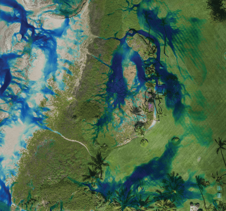
Emergency Mitigation Capabilities
Bare-Earth Terrain Models
Aerial LiDAR: cm-level accurate Digital Elevation Models (DEMs) that strip away dense, storm-tossed vegetation to reveal the true ground structure—accessible safely without risking ground crews.
Hydrology & Watershed Simulation
Flow Modeling: Map new water flow paths, simulate runoff velocity, and identify critical drainage bottlenecks based on the immediate post-storm terrain data.
Change Detection Mapping
Erosion Analysis: Compare pre-storm baseline data against current topography to measure erosion, sediment transport, and exact structural volume loss.
Who We Support
Civil Engineers & Surveyors
Rapidly scale your capacity to take on large public works redesigns without putting ground crews at risk. We deliver the foundational survey-grade data so you can focus on engineering the solution.
State & County (DLNR / Public Works)
Obtain high-fidelity geospatial intelligence to justify emergency funding requests, guide lasting infrastructure redesigns, and prove mitigation ROI.
Need Rapid Topographic Data?
We are actively deploying across Maui to support watershed recovery efforts.